CHINESE ACADEMY OF SCIENCES

-

- Observing Earth: how more than 30 years of China’s meteorological satellite data are used by the world
- (NO.177 July 2021)
- Issue NO:Hot Issue Updated:31-07-2021
China’s first meteorological satellite, Fengyun, was launched in 1988. Since then, 17 more Fengyun meteorological satellites have been launched, with seven still in operation, to monitor Earth’s wind, clouds and, more recently, extreme weather events such as hurricanes and wildfires.
With more than 30 years of Earth observational data freely available to international partners, the Fengyun Meteorological Satellite Program works as part of Earth’s operational observation system, along with the United States’ National Oceanic and Atmospheric Administration satellites and Europe’s polar-orbiting meteorological satellite series to provide a more complete picture of weather events and their global impacts.
The journal Advances in Atmospheric Sciences published a special issue on July 10 to highlight the Fengyun satellites’ data applications and to encourage further research among domestic and global collaborators.
Scientists from the Institute of Atmospheric Physics (IAP) of the Chinese Academy of Sciences (CAS) contributed to the special issue with their analysis of differences of cloud top height between satellites and ground-based radars.
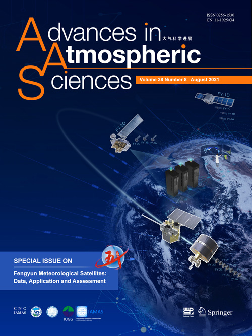
The cover of the special issue shows both geostationary and polar orbiting Fengyun satellites, all of which are circling the full disk image of Earth captured by the FY-4A (center) satellite. Extensive Earth observation data from Fengyun satellites are continuously received and archived in the National Satellite Meteorological Center of China database, which are available to global users. [Image: Advances in Atmospheric Sciences]
“In the last decade, great efforts have been made to improve the performance of the satellites and their on-board instrumentation,” said Zhang Peng, Deputy Director of the National Satellite Meteorological Center of the China Meteorological Administration, who organized the special issue. “With extensive, multi-modal observational capabilities on Fengyun satellites, international communities have and will continue to make use of this data.”
Such capabilities include image navigation, radiometric calibration, multiband optical imaging, atmospheric sounding, microwave imaging, hyperspectral trace gas detection, full-band radiation budget measuring and more — in short, an extensive list of ways to monitor weather events and atmospheric changes of Earth. Zhang also co-authored a data description paper, which summarizes not only the data available, but how international users can access it.
The critical factor, Zhang said, is in how these data can be applied. The rest of the special issue features work undertaken in each of the 2019 conference’s sections: retrieval algorithms, used to interpret raw data; products validation, which cross-references satellite data with Earth-based observations; numerical weather predictions, or how to predict future weather using models of current atmospheric conditions; and climate and environmental predictions, which involves using satellite data to estimate surface effects of atmospheric changes.
On July 5, Fengyun 3E, the world’s first early morning orbit weather satellite was launched. It will improve global weather forecast by filling in the data gap in a certain time of a day and assist in achieving 100 percent global data coverage every six hours.
“Fengyun satellites will continue to play an important role in Earth sciences in the future, especially as the international community continues to collaborate and apply this data to research that benefits us all,” Zhang said. “The new epoch for comprehensive Earth observations has begun.”
Source: Institute of Atmospheric Physics (IAP),
Chinese Academy of Sciences